Preliminary Map of the Bedrock Geology of the Northern Half of the Bedford 30- X 60-Minute Quadrangle, Indiana
Article Sidebar
Main Article Content
Abstract
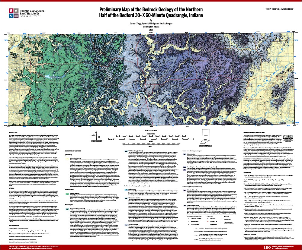
The Preliminary Map of the Bedrock Geology of the Northern Half of the Bedford 30- X 60-Minute Quadrangle, Indiana is an Esri File Geodatabase that contains six feature data sets, five geodatabase tables, and two raster data sets detailing the bedrock geology of the northern half of the Bedford 30- X 60-minute quadrangle in Indiana. This data set conforms to "GeMS (Geologic Map Schema)--a standard format for the digital publication of geologic maps." For more information on GeMS please refer to the supplemental information within this metadata.
Downloads
Article Details
All content for Indiana Journal of Earth Sciences is licensed under a Creative Commons Attribution-NonCommercial 4.0 International License (CC BY-NC 4.0; http://creativecommons.org/licenses/by-nc/4.0/), wherein the author retains copyright. As a service to the research community and as an outlet of its public mission, the IGWS commitment to true open access to scholarly information extends to authors, thus the Indiana Journal of Earth Sciences content is archived at the IGWS and the IU Open Scholar Works Archive.