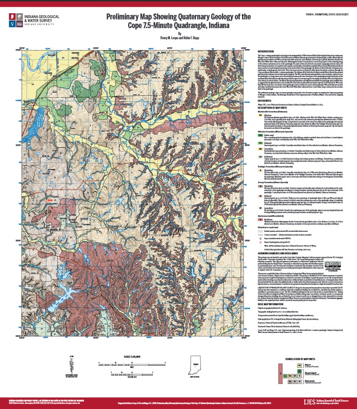
Preliminary Map Showing Quaternary Geology of the Cope 7.5-Minute Quadrangle, Indiana
Article Sidebar
Published:
Mar 10, 2020
Keywords:
geologic mapping, Morgan County, Wisconsin Episode, Illinois Episode, glaciation
Main Article Content
Abstract
Preliminary Map Showing Quaternary Geology of the Cope 7.5-Minute Quadrangle, Indiana
Downloads
Download data is not yet available.
Article Details
Issue
Section
Full Peer Review
All content for Indiana Journal of Earth Sciences is licensed under a Creative Commons Attribution-NonCommercial 4.0 International License (CC BY-NC 4.0; http://creativecommons.org/licenses/by-nc/4.0/), wherein the author retains copyright. As a service to the research community and as an outlet of its public mission, the IGWS commitment to true open access to scholarly information extends to authors, thus the Indiana Journal of Earth Sciences content is archived at the IGWS and the IU Open Scholar Works Archive.